Cow Hollow County Park, Campground, Nyssa, Oregon
Eingestellt von Bernhard am 26. August 2018 - 17:18

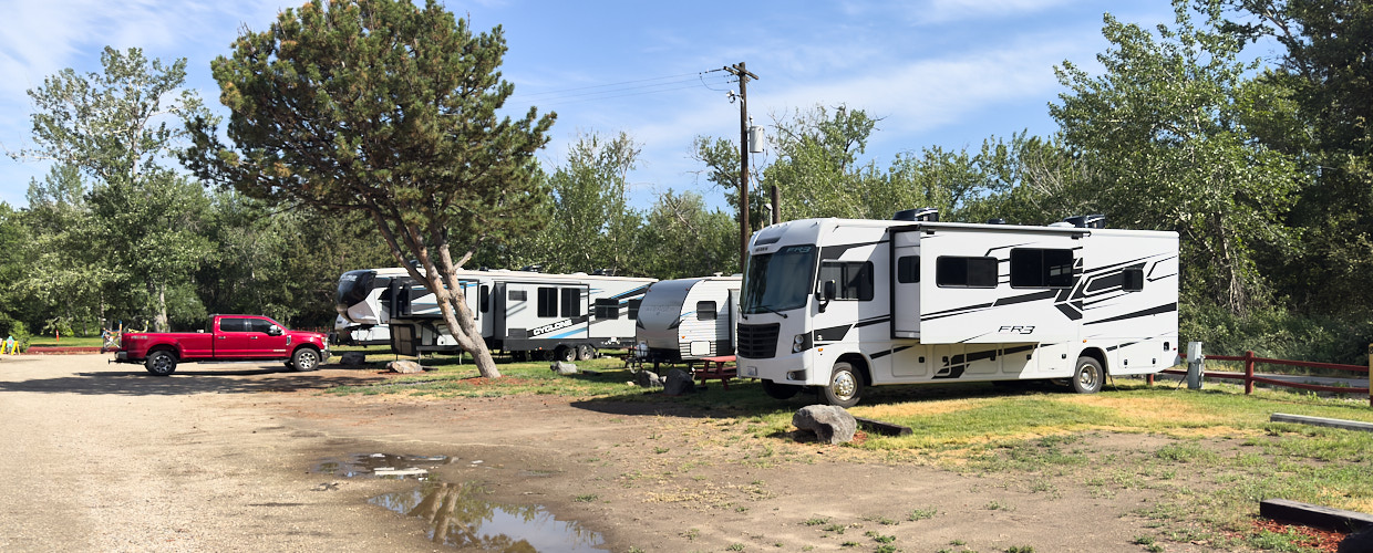
Ein County Park mit 21 RV-Sites mit Electricity, Toiletten und Duschen
Nordamerika im Wohnmobil erleben!
Ein County Park mit 21 RV-Sites mit Electricity, Toiletten und Duschen

Der CG liegt direkt im Süden von Cody an den Hwy 14, 16, 20 einfach, sauber und billig. Nahe am Osteingang zum Yellowstone.


Dieser in 1920 vom CCC errichtete erste Campground Iowas im Tal des Maquoketa River stellt auf 2 Campgrounds insgesamt 125 Sites zur Verfügung: auf dem South Campground je 49 Electric und FHU- und Non-Electric Sites und auf dem Six Pine Campground 27 Non-Electric Sites. Ferner gibt es auch Cabins zu mieten.
-- noch kein Bild vorhanden --
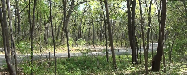
Der Campground befindet sich ca. 14,5 km nordöstlich von Idaho City im Wald, direk an der ID-SR-21. Es gibt keine Dumpstation, aber in 14 km Entfernung kurz vor Idaho City kann eine Dumpstation kostenlos genutzt werden. Self-Check-In, kein Campground Host.

Liegt etwa in der Mitte zwischen Vancouver und Seattle, ca. 30mi südlich von Bellingham. Direkt an der Padilla Bay, gut erreichbar über die I-5 bzw. Hwy-20. 67 Sites in 2 Loops plus 9 weitere für Gespanne bis 50", 29 davon mit Wasser und Elektrik, sowie 6 Cabins.

An einem Stausee gelegener Campground.
--noch kein Bild --
Der Beaver Dick Park am Henrys Fork (River) hat auch nette FcFs Campsites (10$, dry!, Pittoiletten - ID33, 15km westlich Rexburg)

Der CG liegt mitten im Wohngebiet, direkt an einer Straßenkreuzung. Doch der Verkehr geht gegen Null. Es war wirklich sehr ruhig - bis auf die Bahn, die ca alle 1/2 Stunde tutend irgendwo in der Nähe vorbei fährt.

In Hanover, Illinois, turn west on Fulton Street next to Apple River bridge. Follow signs 8 miles to campground.

Das kleine Highlight wurde uns von Einheimischen empfohlen und ist mit einer kurzen und schönen Wanderung von ca. 4 Meilen (round Trip) auf dem McKenzie River Trail verbunden.
Privater RV Park im Grossraum Boise, direkt am Boise River gelegen. Wie für einen Stadt-Campground nicht anders zu erwarten sind die Sites eng.

Übernachtungsmöglichkeit auf BLM Land

Platz befindet sich auf BLM-Gebiet. Viehgatter öffnen - reinfahren - das Viehgatter hinter sich wieder schließen.

Eine kleine Lichtung im Wald, gut geschützt, nur etwa 70 Meter abseits der Road 242. Sehr ebene Zufahrt

Einfacher Campground an der NF 097 (Deer Creek Road) westlich von Hailey ID, die ersten ca 7 mls geteert, dann nochmals ca 3 mls. auf Gravel.

Sno Park am Hwy-20 nordwestlich von Sister im Verlauf des McKenzie Pass-Santiam Pass Scenic Byway. Er kann wie andere Sno Parks in Oregon von Mai bis Oktober kostenlos genutzt werden. Der Byway umrundet den Mount Washington.

Kleiner Campground mit 18 Non-Electric Sites am Nordende und Ostufer des Boysen Reservoir, gut erreichbar über den Hwy-20

Ein riesiger Campground, ziemlich enge Sites.
-- noch kein Bild vorhanden --
Diese Teilstrecke des Hwy-20 vom Valentine in der Nordwest-Ecke von Nebraska führt über 197 Meilen nach Westen bis an die Grenze von Wyoming meist durch unberührtes und friedliches Land. In klaren Nächten kommen besonders "Sterngucker" zu ihrem Recht.

Staudamm direkt an der US 20, welcher kostenlos betreten werden darf.

Schöner privater Campground in Burns, als Zwischenstop von Boise nach Bend oder zum Crater Lake.

Campground nahe Chicago, überlegenswert für Überführer, die sich die Stadt anschauen wollen und trotzdem ruhig und schön stehen wollen.

Camp Sherman liegt in der Nähe von Sisters am Metolius River.

Der Camp Sherman RV Park liegt nur einige Meilen von Sisters entfernt sehr ruhig in einem Wald am Metolius River, verfügt über Full hook up Plätze, jedoch ohne Internet.

Der Cascade Lakes Scenic Byway startet in Bend und führt über 66 Meilen durch das Hochland von Central Oregon. Mit den Seen haben Gletscher und Vulkane eine wunderschöne Landschaft erschaffen.
- noch kein Foto vorhanden-
Nicht schön, gerade noch okay für Übernachtung. Direkt an der Autobahn und auch noch eine Eisenbahn, deshalb sehr laut. Super-Eng, leidlich sauber.
dzt. noch keine Foto vorhanden
Ein ziemlich trostloser ( mehr oder weniger nur ein Kiesplatz ) KOA-Platz auf dem Weg zum Yellowstone NP direkt an der Interstate 25 -- als Übernachtungsplatz zu empfehlen. Achtung Laut, direkt an der Strasse.
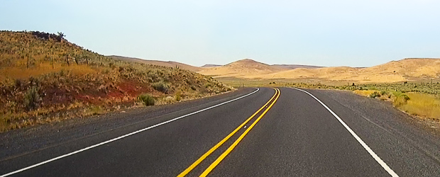
Der Central Oregon Highway zwischen Bend und Ontario ist eine landschaftlich zum Teil sehr reizvolle Strecke entlang der U.S. Route 20 (Hwy-20) in Oregon.

Der Platz liegt am East Lake im Newberry National Volcanic Monument, nicht weit vom Ufer, aber leider gerade so weit weg, dass man vom See nichts mehr sieht. Die Stellplätze selbst liegen unter hohen Nadelbäumen und bekommen wenig Licht.
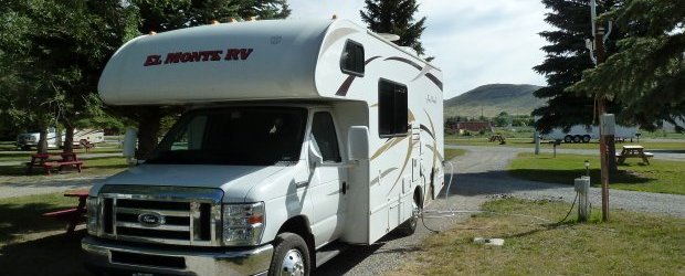
Sehr gut, wenn man für den Cody-Besuch einen Pool und Spielplatz haben möchte. Dafür etwas weiter außerhalb, aber es gibt einen Shuttle.

Ein natürlicher Etappen- oder Durchgangsort östlich vom Yellowstone NP. Besonderes Highlight ist das Buffalo Bill Historical Center, besonders die beiden Abteilungen über die Plains Indians und Natural History.

Es handelt sich um einen ruhigen, weitläufigen Campground mit 31 Sites im Willamette National Forest 35 Meilen westlich von Sisters am Clear Lake.
-- noch kein Bild --
KOA Campground am Fuß der Adirondock Mountains im ländlichen New York State

Hübscher kleiner Picknick- und Campingplatz nicht weit von der US-20, etwa zwei Kilometer östlich von Merriman. Sandiges Wiesengelände mit einzelnen Bäumen an einem kleinen See.

Das Craters of the Moon NM liegt in der Ebene des Snake Rivers im US-Bundesstaat Idaho. Es besteht aus einer vulkanischen Landschaft mit mehreren Schlackenkegeln und großflächigen Lavaflüssen.
Ein ehemaliger KOA Campground in schöner Landschaft gelegen, mit großzügig bemessenen Sites. Die gekiesten Stellplätze haben Sonnenschutz durch große Bäume. Ausgestattet mit Strom, Wasser, Dump, Tisch-/Bankkombi und einem Feuerplatz.

Ein schöner City Park, Wasser (Chlor frei), Abwasser, drei Tage kostenlos!
/
"Come for the water. Stay for the night." Campground und Pool für zwei Personen dry 35 USD, full hock up 60 USD.
Sonst kostet so etwas mindestens das doppelte. Wir bleiben gleich fünf Tage.

Das Dee Wright Observatory liegt auf der Passhöhe des McKenzie Passes, ca.15 Meilen von Sisters entfernt, mitten in einem Lavastrom. Bei klarer Sicht kann man die umliegenden Berge sehen, Mt. Jefferson, Mt. Washington, North Sisters, Black Butte u.a.
-- noch kein Bild vorliegend --
Der Detroit Lake ist ein großer Stausee in den Cascades Mountains - Schwimmen, Boote, Angeln.

Privater Campground, südwestlich des Black Hills National Forest gelegen.
Der Campground innerhalb des Indiana Dunes National Park liegt südlich des Hwy 12, ca 1.3 Meilen vom Ufer des Lake Michigan entfernt
Kleiner National-Forest Campground mit 10 Plätzen entlang des Big Wood River in 6800 ft. Höhe. Ein kleiner Fußmarsch führt zu den Easley Hot Springs.
--- noch kein Bild vorhanden ---
Am Mississippi River gelegenes, einziges National Monument von Iowa mit künstlichen Hügelstrukturen, von denen 31 wie Tiere geformt sind.
-- noch kein Bild --
48 Campsites mit E-Anscluss an den St. Anthony Sand Dunes, die sich 20 Meilen lang und 5 Meilen breit sich hier erstrecken.

Einfachcampground im Deschutes National Forest am Cascade Lakes Scenic Byway auf einer Höhe von 4.900 ft. Direkt am Elk Lake mit einem kleinen Yachthafen und einer Bootsrampe gelegen. Kein Strom, keine Dump-Station.
-- noch kein Bild -
Ernest Miller Hemingway * 21. Juli 1899 in Oak Park, Illinois; † 2. Juli 1961 in Ketchum, Blaine County, Idaho) war einer der erfolgreichsten und bekanntesten US-amerikanischen Schriftsteller des 20. Jahrhunderts. 1953 erhielt er den Pulitzer-Preis für seine Novelle Der alte Mann und das Meer und 1954 den Literaturnobelpreis. Er ist auf dem Ketchum Cemetery in Sun Valley ID unter einer schlichten Grabplatte begraben

Dieser Park ist aufgrund der Bärengefahr nur für "hard-sided" Campinggeräte, also Wohnwagen, Wohnmobile etc. zugelassen. Nüchternes Parkplatzambiente.

Der Militärposten Fort Caspar, 1859 am Ufer des North Platte River als Handelsposten und Mautbrücke auf dem Oregon Trail gegründet, wurde später von der Armee übernommen und die Platte Bridge Station benannt, um Emigranten und die Telegrafenlinie gegen Überfälle von Lakota und Cheyenne in den anhaltenden Kriegen zwischen diesen Nationen und den Vereinigten Staaten zu schützen.

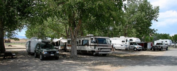
Großer Platz mit zwei Loops auf einem etwas welligen Wiesengelände mit einzelnen Bäumen. Wenig Schatten. Große Sites, relativ dicht beieinander. Strom am Platz, Wasser zentral, Dump Station.

Fort Rock State Park ist ein kleines Highlight als Volcanic Landmark ca. 40 mls von La Pine entfernt. Man kann diese Felsformation erklettern und begehen. Kurz vor den Felsen liegt Historic Fort Rock, mit einem kleinen Museum.

Etwas nördlich von Thermopolis gelegen. 71 Sites, davon 52 fhu, 14 Sites mit elektro- und Wasseranschlüssen, 5 Sites nur Elektro. Drei Pools mit Thermalwasser von 34°C bis 41,1°C im Preis enthalten.
-- noch kein Bild --
Privater Campground zwischen Boise und dem Craters of the Moon National Monument.

Ein City Park mit Badestrand und Pavillon

Ein kleines und wenig besuchtes Gebiet auf dem Weg nach Cody bzw. zum Yellowstone. An der Strasse kann man sehr schöne Felsformationen sehen.

Ein kleiner National Forest Campground (8 Sites) am Mesa Falls Scenic Byway. Hier gibt es Fire-Rings, Tisch-Bank-Kombinationen, Trinkwasser und Stromanschluss!

Sehr netter Campground im Wald. Das Besondere ist die Nähe zur Yellowstone Lake wo man schöne Spaziergänge unternehmen kann.
Sehr gepflegter, neu angelegter Platz unter holländischer Leitung - leider ist das Pfeifen, auch nachts, des Zuges nicht zu überhören.

Hancock Village wurde Ende der 1780er Jahre im Westen von Massachusetts gegründet und blühte bis in die 1950er Jahre als aktive Shaker-Gemeinschaft. Die Shakers waren eine Glaubensgemeinschaft, die 1774 aus England in die Kolonien übergesiedelt war. Der Name entstand aus den ekstatischen Bewegungen während ihrer Gottesdienste. Hancock wurde in sechs Familiengruppen eingeteilt und bestand aus Gemeinschaftswohnungen, Handwerksläden, einem Versammlungshaus und Scheunen.

Das 1936 von Präsident Franklin D. Roosevelt zum Schutz des gefährdeten amerikanischen Pronghorns gegründete Refuge beherbergt eine Vielzahl von Fischen, Wildtieren und Pflanzen, die in dieser ruhigen abgelegenen Ecke des Oregon Outbacks gefunden werden.
-- noch kein Bild --
Ein kleines Erosionsgebiet im Südosten von Wyoming, das man eher in Utah verorten würde: Hodoos, Badlands und farbige Felsen an einer Abbruchkante, über die die Native Americans die Bisons bei der Jagd trieben.

Ein staatlich geführter Campground in kurzer Fahrdistanz zum Westeingang des Yellowstone National Park.
Die Sites liegen am Ufer des Henrys Lake und bieten eine herrliche Aussicht auf die umliegenden Bergen.

Hot Springs, Sinterterassen, ein Schwimmbad mit Rutsche, alles was Kindern Spaß macht.

Der Campground liegt 10 mls von Mammoth Hot Springs entfernt, sehr ruhig gelegen. Der CG liegt abseits vom grossen Rummel, viele Zeltler. Tiere (Squirrels, Deers, Dachs) direkt auf dem Campground.


Der CG im State Park eignet sich zum Besuch von Chicago, wenn man eine Bahnfahrt nicht scheut. Vom Park kann man zu Fuß die Bahnstation, Haltestelle Dune Park, erreichen, mit dieser ist man in ca. 80 Min. in Chicago.

Ein ruhig gelegene, einsamer CG mit großen, weit voneinander entfernten Sites. Es gab Bänke, Feuerringe, Trinkwasser und ein Plumpsklo.

Campground in einem State Park mit Blick über Weinberge und einen der Finger Lakes. 150 Tent und Trailer sites, 53 davon mit E-Anschluss

Der Campground liegt direkt am Lake Erie. Stellplätze sind sehr groß und mit vielen Bäumen teilweise schattig. Stromanschluss an jedem Platz, Wasseranschluss gibt es nicht.

Der Lake Shore (früher: North Shore) Campground (32 pull-through Sites) liegt im Buffalo Bill State Park, 6mi westlich von Cody auf dem Weg zum Yellowstone N.P. Einige der Sites liegen direkt am See. Reservierbar. Feuerringe vorhanden.

Der CG liegt inmitten von großflächigen erkalteten Lavaströmen und einiger Schlackenkegel. Der 7 Meilen lange Loop Drive ist zwischen Mitte November und Mitte April für den Straßenverkehr geschlossen.

Eine einzigartige Ansammlung von Zeichnungen. Über 400 Meter lang.
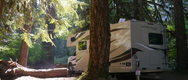
Kleiner, idyllischer "primitive campground" im lichten Urwald am klaren Gebirgsfluss. 12 sites, keine Services außer 1 Plumpsklo. Offen von Mai bis September.

Die Little City of Rocks ist ein Canyon mit wunderbaren Gesteinsformationen. Sie liegt nördlich von Twin Falls und nördlich von Gooding

Etwas abseits des Touristenstroms mitten im Deschutes National Forest an den Ufern des Paulina Lake liegt dieser tolle Campground unter concession des USFS.

Tolle Lage am östlichen Arm des Hebgen Lake, Zufahrt über ca. 5 mls (gute) Schotterstraße. Baden, Schwimmen, Kanufahren.

Sehr schöner CG, romantisch im Wald gelegen. Bisons und sonstige Tiere (die Mülleimer weisen auch Bärenkratzspuren auf) campen mit.

Dieser 82 Meilen lange Scenic Byway führt in Central Oregon nordwestlich von Bend durch ein kontrastreiches Gebiet mit verschneiten Vulkangipfeln, durch Wälder und Lavafelder

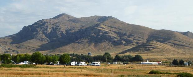
Etwas abgelegen am Westabhang der Bighorn Mountains im nördlichen Wyoming auf einer ehemaligen Working Cattle Ranch finden sich hier 20 in drei Gruppen angelegte Campsites (ein Teil davon auch mit Elektro-Anschluss). An einer 750 ft langen Sandsteinwand finden sich Hunderte von Petrpglyphs und Pictographs aus der Besiedlung der Region seit 10 000 Jahren.

Ein schöner, kleiner Byway (knapp 30 mls) auf der Strecke von Salt Lake City zum Westeingang des Yellowstone Parks.

Ca. 25 Meilen westlich von Cody an der Zufahrt zum Osteingang des Yellowstone National Park gelegen. Full hook up, ebenmäßige Stellflächen, Tisch-, Bankkomination auf Zementplatte, Feuerstelle, großzügige Sites in Terrassenform angelegt, so dass es viel Platz zwischen den Stellflächen gibt.
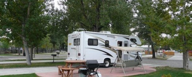
Gepflegter Platz mit ca. 30 Full-Hookup-Stellplätzen mit etwas Schatten auf Kies, sehr eben. Fast alle Drive-Through.
Meereshöhe: 1.600 m

Ein sehr interessantes, vom BLM verwaltetes Museum, das die unterschiedlichen Wanderungsbewegungen über den amerikanischen Kontinent zur Besiedlung des Westen darstellt. Man kann sich hier mehrere Stunden aufhalten.

Der Newberry Vulkan ist der flächenmäßig größte Vulkan in der Kaskadenkette. Die faszinierende Lavalandschaft ist an vielen Stellen zugänglich, besonders zu empfehlen ist die Newberry Caldera mit dem Paulina Lake und dem Obsidian Flow.

Es handelt sich um einen "First come first served" CG. Liegt ziemlich zentral im Park.

Einfach nur ein wunderschön gelegener, ruhiger, weitläufiger Platz. Die 14 Plätze am ersten "Ring", gesehen von der Zufahrt, sind reservierbar.


Schön gelegener Campground. Insgesamt 36 Stellplätze. Alle Sites mit Feuerstelle,Tisch/Bank Kombi. Trinkwasser, Müllcontainer und Vault Toilets vorhanden. fcfs.

Einer von mehreren im Willamette National Forest direkt am Mc Kenzie Hwy ( SR-126) gelegener Einfach-Campground. 64 Sites, viele liegen wunderschön unter hohen Bäumen direkt am Mc Kenzie River.

In 2020 neu angelegter privater Campground an einem See in einem bewaldeten Gebiet von Massachusetts mit 200 RV Sites mit FHU, Pool, Cabins und vielen Angeboten

Ein Teil der 19 Stellplätze liegt sehr schön am Ufer des Metolius River. Es gibt keine Hookups, aber Wasserzapfstellen und die üblichen Trockentoiletten sind vorhanden.

Ein schön angelegter Citycampground in Cody. Die Plätze sind ausreichend groß, Santäre Anlagen sind sauber. Buffalo Bill Museum und Downtown fußläufig zu erreichen.

Geteerter Übernachtungsplatz mit Blick aif die Yaquina Bay Bridge und die an der Marina liegenden Boote

Lusk liegt verkehrsgünstig auf dem Weg vom Mt. Rushmore nach Denver, vielleicht sogar für die Strecke Badlands-Denver

Ein kleines,sehenswertes Freilichtmuseum. Anfahrt erfolgt über eine Gravelroad.
-noch kein Bild verfügbar-
Es liegt etwas abseits von Terrebonne, sehr schön über einem Canyon, wo der Crooked River fließt. Sehr ruhig gelegen. In der Nähe befindet sich ein Golfplatz, an den auch ein RV Park angeschlossen ist.

Klassischer kommerzieller CG gut für eine Zwischenübernachtung geeignet. Es gibt wenig grün, eigentlich ist ein riesiger Schotterplatz.

Riverside Park Camground ist ein National Forest CG am Ufer der Henry´s Fork des Snake River.
Er liegt auf dem Weg zum West Eingang des Yellowstobe National Parks

Ein schöner City Park am North Platte River. Alle Einrichtungen. Alles Kostenlos. Gepflegtes Sanitär, warme Duschen, chlorfreies Wasser, Dump Station.
--noch kein Bild --
Privater Campground in Bend, Zentrum zu vielen sehr schönen Zielen östlich der Cascades.

Herrlicher, stattlicher CG, direkt am Missouri River in Nebraska gelegen, über eine Brücke kommt man leicht zum interessanten Teil der Stadt Sioux City, die in Iowa liegt.

CG liegt mitten in der Stadt. Teilweise mit Full Hook up. Man kann in 10 Minuten zu Fuß den Ort erreichen.

Der Campground liegt schön gelegen direkt am Niobrara River. 18 miles east of Valentine. Es gibt einige einfache Trails, u.a. auch zu Nebraskas größtem Wasserfall.

Nett gelegener CG auf dem Weg zum Yellowstone NP. Liegt in einem nicht besonders schönen Industriegebiet, ist aber selbst recht grün und vom Industriegebiet sieht man nicht viel.

Suttle Lake liegt bei Sisters in den Cascade Mountains, drei Campgrounds, alle auch für RV, liegen am Südufer des Sees.
-- noch kein Bild --
Gut ausgerüsteter, "Adult only"-Campground mit Fill hookup Site auf einem bewaldeten Grundstück. Neben Residents auch Plätze für kurzfristige Gäste
-- noch kein Bild --
Sanddünen aus weißem Quartz Sand westlich von St. Anthony an Hwy-20 mit einer Höhe bis zu 400 ft. Im Sommer röhren die OHV, im Winter die Elks. Man kann die Dünen aber auch zu Fuß erkunden.

Eine landschaftlich besonders schöne Straße im Südosten von Oregon. Die in Frenchglen beginnende Steens Mountain Loop Road (59 Meilen Gravelroad) ist Oregons höchstgelegene Straße.
Für Wohnmobile möchte ich die Loop Road aber nicht empfehlen - wir fuhren sie mit einem Truck Camper.

Campground in unglaublicher Lage irgendwo im Nirgendwo (im Südosten Oregons - wo niemand hinkommt) in der Hochwüste gelegen. Grosse Sites mit und ohne Hook-Up. Dumpstation. Laundry.

Es handelt sich um einen Luxusplatz, der alle Annehmlichkeiten bietet, jedoch vom Preis her in der oberen Kategorie einzuordnen ist. Die Sites sind sehr großzügig angelegt, Lage absolut ruhig!

Privater, weitläufiger und ruhiger Campground mit viel Grünflächen. DIe Stellplätze sind wie bei privaten üblich nicht sehr groß, aber grün. Leveln war nicht erforderlich.

Direkt am Wasser gelegen mit grosszügigen Sites und einer tollen Baumlandschaft inmitten der Berge.

Schön gelegener Campground direkt am Boysen Reservoir. Sehr großzügige Sites. FCFS

Es gibt keine Dumpstation, aber in 13,5km Entfernung kurz vor Idaho City kann eine Dumpstation kostenlos genutzt werden. Self-Check-In, kein Campground Host.

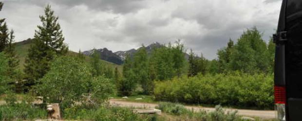
70 Meilen langer Scenic Byway entlang der "ruhigen Seite" der Teton Range zwischen Hwy-26 und Hwy-20.

Rest Area entlang des Ohio Turnpike mit extra ausgewiesenen RV Parkplätzen.
Gut geeignet für eine Übernachtung bei längeren Fahrten.

Einfacher fcfs - Forest Service Campground ohne Wasser (aber Vault Toilets) in einem Badlands-Gebiet mit Toadstool Hoodoos, gelegen innerhalb des Oglala National Grassland.

Einer von insgesamt 11 Campgrounds im Boyson State Park.
Auf einer Halbinsel gelegen mit teilweise sehr großzügigen Sites. Alle Sites mit Zugang zum See.

Schöner State Park 7 Meilen nordöstlich von Bend am Deschutes River gelegen. Sanitärgebäude sauber und große Einzelduschen vorhanden.
-- noch kein Bild vorhanden --
Der Platz ist etwas eng, aber so ist das halt oft bei privaten Stadtcampgrounds ---
zu empfehlen, wenn im Yellowstone alles voll ist. Vom Eingang West nur ca. 2-3 Meilen entfernt.

Wapiti CG: ein schön zwischen leuchtend roten Felsen und dem Shoshone River gelegener Nat.Forest Campground, der sogar Stromanschluss hat, was bei niedrigen Nachttemperaturen sehr von Vorteil ist. Einige Sites unweit des Flusses.
60 Sites in einem Waldgelände am Rand eines Ponds (Vorsicht Mücken!)

Das Willamette Valley ist von Eugene bis zum Columbia River ein 150 Meilen langes Tal in Oregon, das auf drei Seiten von Bergen umgeben ist: der Cascade Range im Osten, der Oregon Coast Range im Westen und den Calapooya Mountains im Süden. Der Willamette River fließt über die gesamte Länge durch das Tal. Es ist ein Synonym für das kulturelle und politische Herz von Oregon und beherbergt etwa 70 Prozent seiner Bevölkerung, darunter die fünf größten Städte des Bundesstaates: Portland, Eugene, Salem, Gresham und Hillsboro.
--- Leider noch kein Bild vorhanden ---
15mi nördlich von Norfolk, Nebraska gelegen befindet sich der Campground im Willow Creek Recreation Area direkt am Ufer des gleichnamigen Sees. Von den 100 Sites sind 83 mit Elektrik ausgestattet. Kostenpunkt: 18$ - 25$

Der Wind River Canyon ist eine Felsenschlucht entstanden durch den Wind River*) und liegt zwischen den Städten von Shoshoni und Thermopolis.
Privater Campground in Thermopolis

Gepflegter Campground mit engen Stellplätzen und full hookup, nur 3mi zum Westeingang des Yellowstone-Nationalparks.

Muss man gesehen haben, denken sich jedes Jahr über 300.000 Besucher. Egal, dieses von Geysieren, heißen Quellen und allen Arten Wildtieren beschenkte Gebiet ist sensationell.

Bis zum West-Eingang des Yellowstone-Parks sind es ca. 6 Meilen. Eine Alternative, falls im Park alles belegt ist oder falls man nicht auf Full-Hookup verzichten möchte.